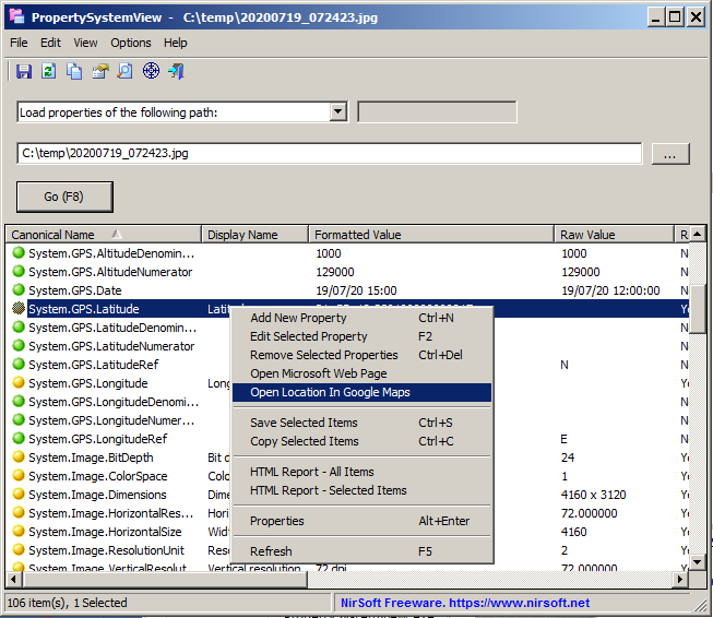
The new versions of PropertySystemView and ExifDataView allow you to easily open the location of .jpg file in Google Maps. This feature works only for .jpg files that contain GPS information (Also known as ‘Geo-tagging’ ).
In order to use this feature, simply open the desired .jpg files with the PropertySystemView tool or with the ExifDataView tool. Click with the right mouse button on the main window and then choose the ‘Open Location In Google Maps’ menu item. The tool will open the location of the image in Google Maps Web site, using your default Web browser.

Leave a Reply